TorontoToronto for the corrections of the whole Canada and whole world.
Toronto Edmonton
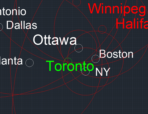
Toronto Ottawa
Toronto Vancouer
Toronto Denver
Toronto Puerto Vallarta
Toronto Winnipeg
Toronto Halifax
Toronto LA
Toronto Puerto Vallarta
Toronto Mexico
Toronto KEF
Toronto London
Toronto Istanbul
Toronto Lisbon
Toronto Tel Aviv
Toronto Delhi
Toronto Addis Ababa
Toronto Hong Kong
Toronto Beijing
Toronto Tokyo
Toronto Manila
Toronto Honolulu
Toronto NY
Toronto Denver
Toronto Atlanta
There is connection with 25 cities! This is a kind of record. For an easy work, I'll choose spesific ones. Nearest and furthest ones.
Toronto LA
3.498 3.834
3.700 corrected as 3.389
4:30 852
Toronto London
5.713 5.700
5.500 Corrected as 4.610
6:20 900
Toronto Istanbul
8.208 7.888
7.612 corrected as 6.268
8:50 893
Toronto Hong Kong
12.562 12.992
12.537 corrected as 9.777
14:30 896
Toronto Beijing
10.573 11.208
10.815 corrected as 7.686
12:19 910
Toronto NY
589 957
923 Corrected as 589
1:22 700
Toronto Denver
2.113 2.149
2074 corrected as 2.190
2:35 832
Toronto Ottawa
357Toronto Atlanta
1100 Corrected as 862
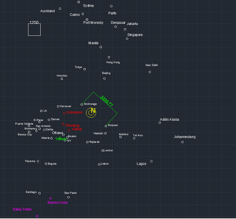
Toronto Edmonton
2.693Toronto Winnipeg
1.500Toronto Halifax
1.200Toronto Boston 693
I chosed 13 of all cities.
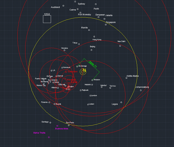
Perfectly matched. I know you did not understand anything. The important thing is the selected place must stay inside all of circles, and should be stay in about intersection of nearest cities. I'll chose a place like this:
Selected place corrects whole cities. I'll correct the further distances and find out the exact values.
First I'll type google values. If it stays outside, correct it to true value by shrinking the circle on the shape. If it stays inside, I'll correct it by using flight times.
Toronto Vancouer 3357 corrected as same!
Toronto Denver 2.160 corrected as same!
Toronto Puerto Vallarta 3.504 corrected as same!
Toronto Mexico City 3262 corrected as same!
Toronto Rejkavik 4.195 corrected as 2.863! (support to the theory of center is smaller)
Toronto Lisbon 5.726 corrected as 4.909
Toronto Tel Aviv 9.268 corrected as 7.676
Toronto Delhi 11.628 corrected as same!
Toronto Addis Ababa 11.476 corrected as 10.431
Toronto Tokyo 10.346 corrected as 7.550 !
Toronto Manila 13.212 corrected as 10.316
Toronto Honolulu 7.485 corrected as 6.126
Intersection of whole cities:
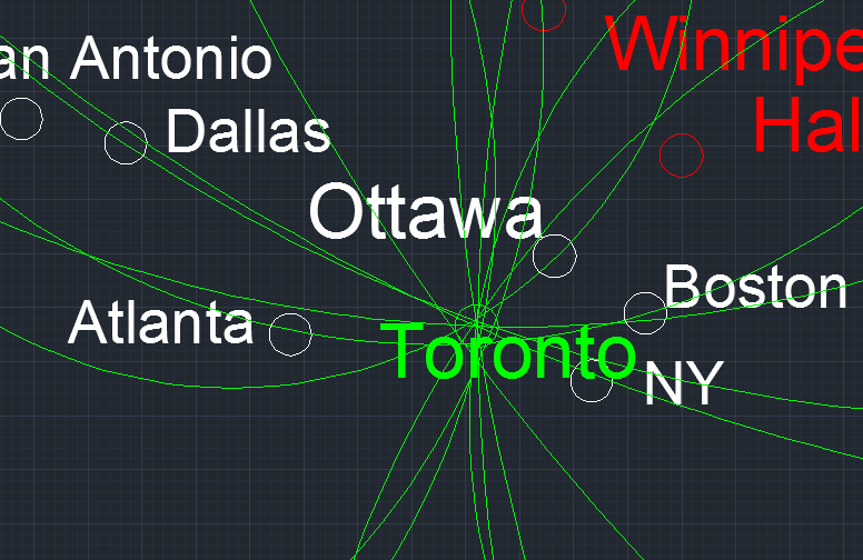
As we see that, there is a perfect intersection and all distances are true considering this place.
As a result;
Toronto is added as a perfect center of the earth that proves the whole map. Thanks Toronto!
Additional cities:
Buenos Aires 8960 corrected as 6.326
Santiago/Chile 8618 corrected as 6.099
Proves.
As a result Toronto is added and colored as green to show it proves whole map from Africa to Europe; from Asia to Ocenia, from South America to North America, shortly whole world. It will stay always green because it proves whole cities in our map. This city definitely stays here.