So I was looking at this flat earth map:
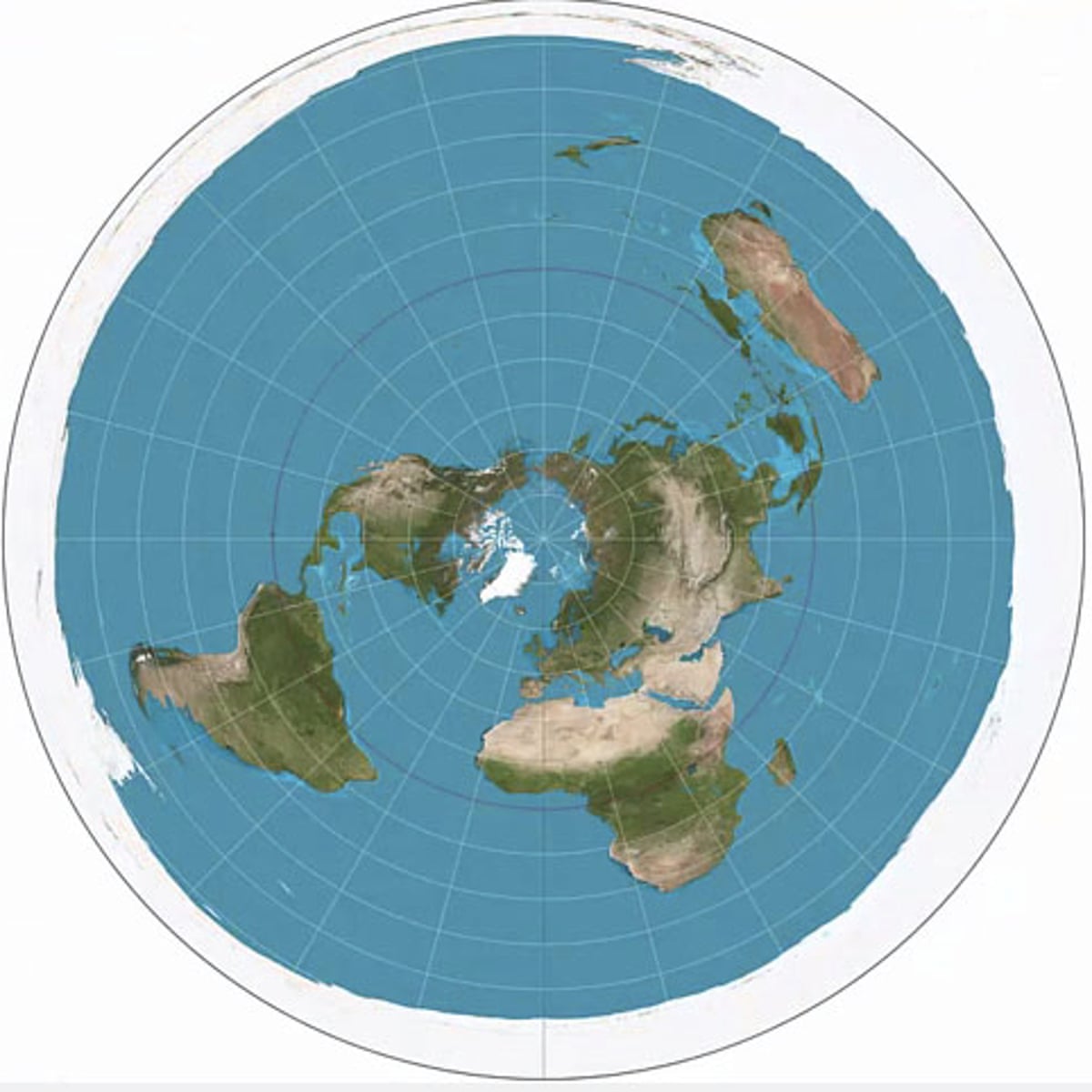
And, assuming this model was correct, I was wondering how one would fly from, for instance, Johannesburg SA to New York City, USA (these are just examples, you can sub in many different cities). The shortest and most practical route would be over the north pole, yet no flights ever pass over it. What they usually do is travel east from Johannesburg along with the curved lines and fly in what would appear to be a very large arc, passing over Guiana.

(yes, I know this is a globe earth model, but the route should be the same regardless of model)
So now I have 2 questions:
1. According to google maps, this travel would take around 22 hours. Now, on that flat earth model, using the same route, the trip would either have to take twice as long at normal speed or the plane would have to be travelling twice as fast. Do planes on that route get an extra speed boost or something? How are they able to make it in such short time? Additionally, are they equipped with and extra tank of gas, as a regular plane doesn't hold enough fuel for a trip of this length?
2. Why don't they just travel over the north pole? It would be much quicker, cheaper, and efficient.
P.S.
with a plane traveling along that intensely curved route, wouldn't the passengers be consistently dumped on their sides for the vast majority of the ride, seeing as in order for a plane to turn it must bank?