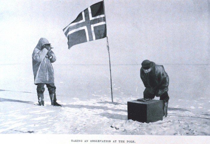
I'm fairly sure Amundsen used sextants to find the south pole on the basis that it was the point where the sun's height didn't change throughout the day. Anyway, here he is using one:
Since the south magnetic pole is quite a long way from the geographic one (at about 64oS) a magnetic compass would be far from redundant.
I think GNSS is also operational but with reduced accuracy as the satellites don't get so high in the sky.
it's like you're using words and then not applying the meaning to the sentence you created...
Magnetic south pole wanders, right? So does the geomagnetic one...albeit at a slower rate and there's all sorts of hypotheses out there to explain this.
Anywho - say amundsen uses a "sextant" to take "notes" on the differences in readings between the height of the sun where he's at and whatever his magnetic compass is telling him.
How does he progress?
I mean think for a second. You're sitting in whiteout conditions with a sextant and the height difference of the sun here has not really been observable since passing south of the 77th parallel....probably alot earlier.
For "GPS" Anyone wanna verify this picture?

Admunsen Base also supposedly has a "land based gps" system...but I'm having trouble connecting - a Trimble NetR8
https://www.unavco.org/projects/project-support/polar/base_stations_and_survey_systems/southpole/base.html"With proper roving equipment, the system can be used as a base for centimeter-level post-processed surveys up to a 100 km radius"
So - a 62 mile radius around what they're claiming is the south pole.
Cool