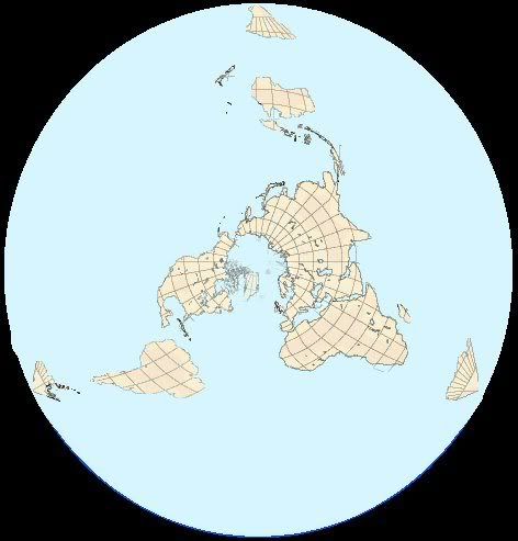
I've been considering the problems that FE has in terms of geography and during my trawls of the internet I found a 'North polar tetrahedral projection' map of the earth

Now after a bit of playing i've converted this to a basic FE map. It solves the problem of the misshapen continents, the only problems with it are the size of the southern oceans and the massive stretching of Antarctica (Not done on this WIP, imagine the three Antarctic 'islands' spread around like the traditional icewall map