Show Posts

This section allows you to view all posts made by this member. Note that you can only see posts made in areas you currently have access to.


Messages - Yib

Pages: [1] 2 3 ... 5
1
Flat Earth Debate / Re: 1m Wave block 100m building
« on: November 01, 2018, 04:50:46 PM »
...the calculation was done according to perspective...

If you ever expect to be persuasive with this "side-view perspective" argument, you're going to have to show/explain how you perform your calculations.

I'm on the other flat earth forum as Bobby Shafto, and I and others have expressed our critiques there, but you're over here repeating the same errors. At least the errors we conclude from your presentations and subsequent follow-up. You're not getting OUR point.

If there's a language disconnect, maybe mathematics will bridge the gap.

The first order of business I would ask is for you to explain how you arrive at distance values for the horizon. I've asked before and you said it was complicated and requires experience. So, help me develop that experience. I live on a coast and I can see the horizon from the shoreline, from 30m bluffs, from 120m hills and from 250-500m coastal "mountains." I can use my 20/20 (corrected) "naked eye" vision resolution, my 200mm-equivalent camera telephoto lens and HD resolution, and I'll soon have a decent enough long-tube refractor telescope for terrestrial digiscoping that will allow me even better distance viewing (atmosphere and "waves" permitting.)

I want to learn how you determine the distance to the horizon.

After that, you can show me how you calculate 1m obstacle on that horizon blocks heights beyond that horizon for eye-level at that 1m height. It doesn't make sense to me. If there's an inverse-distance (ID) curve that produces a perceived rising effect of objects that are at eye-level, I'd like to know how that is calculated, and how to calculate a "shadow" or "hidden" area beyond that.

Currently, no model I know incorporates such an "ID curve" factor.  You started out with a good observation of how objects appear to diminish in size not linearly but inversely according to distance. But beyond that, you seem to go off the rails and make leaps of reason that don't make sense, at least not to me. And since you persevere without seeming to address the criticism, I'd like to make sure I'm not missing something that you've discovered in the math(s). So instead of just asserting it, can you show us how it's done? It's okay if it's complicated. If the concept you are trying to convey is to make any headway, you have to do that eventually; because it'll never convince anyone if it's based on the Art and Devices of Zorbakim and we have to take your word for it. You need to show us how it's done.

Feel free to do it here or on the other flat earth society forum. Or via YouTube. That actually might be best. Just let us know when it's posted.

2
Flat Earth Debate / Re: 1m Wave block 100m building
« on: October 20, 2018, 04:43:27 PM »
If the earth is flat, something at or below eye level will never obscure more than its own height of something more distant.

If eye level h=1m, and an obscuring object is also h=1m, the most of a more distant 100m object that can be be hidden by the smaller, nearer object is 1m...if the earth is flat.

Perspective makes a 100m appear smaller as its distance increases, but in also makes the 1m obscuring object appear smaller. And, on a flat earth, the 1m object can never rise above the 1m eye level. As well, 99m of the 100m object will never drop below eye level. It's geometrically impossible for a 1m object to hide a 100m object on flat earth, no matter the distance or how much you zoom in or out.

Using Walter Bislins' Advanced Earth Curvature Calculator in Flat Earth Mode to demonstrate:

3
Flat Earth General / Re: Problems with the Heliocentric Model
« on: July 13, 2018, 05:53:48 AM »
Edit: Yib, are you forgetting to change the camera focal length when you move the camera closer?

I wasn't using a camera but manipulating existing photos, but...


...rab found a good example of what you're talking about. Though not the explanation for that image #7, the composite image can be defended as realistic for a given focal length. 

4
Flat Earth General / Re: Problems with the Heliocentric Model
« on: July 12, 2018, 11:15:32 PM »
That's a really nice video. You do a good job with those.

5
Flat Earth General / Re: Problems with the Heliocentric Model
« on: July 12, 2018, 10:47:55 PM »
That image was taken closer to the earth. My estimate is that shot was taken from 1.4 earth radii away.

Found it. Try 512 miles away.

It's a composite built from images taken by the sun-synchronous weather satellite Suomi NPP. I think they gooned it by trying to make a "blue marble" image from the strips that the satellite could capture. Large portions of what should have been the sphere of earth at that scale are missing, so I'm guessing they just rounded it off to make it look spherical. But it's not in proportion to how much area on the globe those images would occupy.

I think skeptics are right when they call that one out.

(I give NASA the benefit of the doubt that they weren't trying to deceive. They just wanted to highlight the hi-res images that Suomi NPP captured for public-facing publicity is my take. I don't think NASA officials really pay much heed to catcalls of "fakery" or shy away from acknowledging composite imagery. )


Quote
"A view of most of North America taken from a low orbit of about 826 km altitude. The whole hemisphere is not visible owing to the low orbit, and the horizon is at a distance of about 3,300 km, while the radius of the planet is 6,371 km. The diameter seen from this height is about 125 degrees. "
https://en.wikipedia.org/wiki/Suomi_NPP#/media/File:North_America_from_low_orbiting_satellite_Suomi_NPP.jpg

6
Flat Earth General / Re: Problems with the Heliocentric Model
« on: July 12, 2018, 10:32:42 PM »
It doesn't look right. Mexico and the Yucatan take up too much surface area of the visible sphere, proportionally speaking. If it's closer, then the entire sphere must become larger.

I took my two 3D models and added a 3rd using a skin from Google Earth. See how large I have to make the globe in order to match the size of the isthmus between the Americas? And there's all kinds of missing Pacific Ocean.


A wide angle lens would probably distort the edges to compress the area toward the edges to keep the sphere small as distance decreased.  That image just does not scale proportionally compared to the others. I can't quite figure out what was done to achieve that field of view of earth's surface without increasing the diameter of the globe.

The other 7, plus to 2 that theRealDill posted, all "work" in my opinion. They scale properly, based on the details one can see. It's just that 1 oddball in which Mexico/C.America just takes up too much of a chunk of the sphere's visible area. I can't duplicate that view in simulation or modeling.

7
Flat Earth General / Re: Problems with the Heliocentric Model
« on: July 12, 2018, 08:52:32 PM »
I think you mean this:


Using a pair of 3D globe models, I oriented with the associated globe images in that meme (#1-8), plus the two images linked from NASA directly (#9 and 10). The only one that seemed out of whack was #7 in which North America/US takes up much to much of the globe area. It looks like it was given a circle crop around the US and given a fisheye-type warp to make it look globular.

The others look consistently proportional. It's not a secret that many (most? all?) images of earth are colorized, enhancing the blue of the oceans and green of landmasses.

1.

2.

3.

4.

5.

6.

7.

8.

9.

10.

8
Flat Earth General / Re: Looking for people to do some experiments
« on: July 02, 2018, 10:13:28 AM »
I didn't get much interest in the experiment sadly. Here's a video of my own results and the ones I got from Bobby Shafto.


Watch it and see if your expectations about perspective match up with experiments.
It's too bad you didn't get more participation. I know some who initially seemed interested might have dropped out once they detected where it might be leading.

9
That is fantastic work!

Let me toss a monkey in the wrench. Is the FE moon a sphere or a disk?
If it's a sphere, do San Diego and Brisbane see the same face of that sphere at the same time?

Ok, so is it a disk then? Do San Diego and Brisbane both see the disk as a circle from their angle?
That's a whole 'nother set of complicating issues.

10
That's totally wicked dude! Beware that those orange moons Stellarium draws means the moon will be very close to the horizon. It's doing an impression of the sunset effect caused by refraction. Is that showing 2.2 degrees above the horizon? I always advise people to rely on observations that are less tainted by distortion effects. The distortion we see near the horizon is a whole different topic, and I advise you not to mix the two.
I noticed that, but it was a vertical distortion obviously based on a standard refractive index, which wouldn't impact azimuth or "moon rolling" observations, which are the key elements we're after. I thought about sliding the time to the right a half hour or so for Brisbane to have a moon higher in the sky, but if there is any notion of Rab and me actually taking photographs, 3AM is already too late/too early for me. It probably can't happen anyway since this time of year here, the cool ocean air has brought the clouds inland and I won't be able to see the moon much after midnight.

I don't think this addresses what Appaullingly was after with the OP, but if on the next full moon we want to try some simultaneous picture-taking, this Stellarium tool would be a good way to predict what we should see, at least if the earth is a globe. Flat earth has a long way to go to be able to make predictions.

11
But now what might Flat Earth predict? Without a sim/model like Stellarium or an agreed-upon representation of the flat earth, it's hard to say. But using the standard visualization of what a disc-shaped flat earth, equidistant azimuthal-like "map" of flat earth, we can see it doesn't work:


Straight lines are straight lines on a flat earth map, and if I put the moon where TimeandDate says the moon is over the earth at 1000 UTC, I can get what seems to be a fairly decent radial line from San Diego (just east of due south). But Brisbane is all wrong. Instead of rising ESE, the moon should be appearing ENE at moonrise. Not only that, but since the moon would still be arcing on it's circle just inside of the Tropic of Capricorn, it would still show some left-to-right (southerly) drift during its morning rise before reversing and drifting right-to-left.

The "tilt" is wrong too. It's mirror opposite of what Stellarium predicts.


The red star is the "top" of the moon as seen from San Diego. But on flat earth, the blue star would be what Brisbane sees as the top, and the arrow is showing the moon's projected vector at moonrise, which is around 90 degrees off from what a globe earth predicts.

To square with what is predicted (and I'm confident would be observed were we to do this), the map for flat earth needs significant adjustment and/or some actual spin to the  moon may be theorized; however what we'd probably find is that whatever adjustments we'd make for the model to work for San Diego/Brisbane would foul up observations comparing other locations.

12
Suppose rabinoz (Brisbane) and I (San Diego) were to photograph the waning gibbeous moon simultaneously at 1000 UTC, July 1st, 2018. 

That would be 3AM California time and 8PM Queensland time.

For me, the moon would be nearly due south and at approaching its highest elevation for the night. For Rab, the moon would be just rising.

Stellarium predicts the following orientation for each of us:


The arrows show the apparent motion of the moon as it is rising just past vertical from right to left as viewed from Brisbane, but from San Diego, I'd be seeing it nearly "tipping over" approaching horizontal as it passes left to right.

The projection of the globe earth from TimeandDate shows where the moon is at its zenith over the globe earth at this moment. And it makes sense. The azimuths each of us would be seeing the moon on make sense (Brisbane's great circle straight line looks curved on the flat projection of the globe). And the "top" of each of our moons is tilted correctly relative to the moon's motion, with the Mare Crisium along the leading edge. From San Diego, I see Mare Crisium tilted clockwise from vertical. From Brisbane, Rab would see the Sea tilted (less) counter-clockwise. You have to perform a little mental gymnastics to imagine yourself looking up at the moon. Looking down at the chart, Mare Crisium is on the left, westward-facing edge. "Top" of the moon for each observer is where the azimuth line touches the moon.

For globe earth, everything lines up. All we'd have to do is actually observe the moon to confirm what Stellarium, TimeandDate and Mooncalc predict.

13
Comparing Stellarium's presentation of the moon with what we actually photographed:

From San Diego on June 26th:


From San Diego on June 27th:


From London on June 27th:


From Brisbane on June 28th:


From San Diego on June 28th:


Provides pretty high confidence that Stellarium provides a good predictor of how the moon will appear to be oriented from earth locations at given times.

14
Check out Stellarium http://stellarium.org/
That will let you punch in any day, time, and place and center your view on the moon. Fiddle with the date to see how things change day to day. Fiddle with the latitude and see what that does, fiddle with the longitude and see what that does. They all cause the moon to roll.
This is pretty awesome. Thanks for the pointer. I'll play around with it and see if it answers my questions (and if it depicts the moon as I actually see it.)


15
Imagine you and I could convince Tom Bishop to participate, assuming he's in the Bay area. We'd have 3 California locations observing the moon simultaneously. Let's say it's the next full moon in July 27th, 11pm PDT.

Before taking photos and comparing/analyzing, what does a globe earth predict? How will each of our moons appear? Which part of the moon is the index for measuring "rotation"? How much will our moons deviate from that index or from each other?

I don't know how to figure that? I know FE model hasn't built any such predictor, but has RE? Before we can challenge FE, we need to have a RE prediction. I'm not (yet) seeing a descriminator between FE and RE using this moon characteristic. All that's been claimed is that "rotation" occurs. How earth curvature imparts an effect that's distinguishable from the azimuthal influence --that's also explicable on a FE  -- hasn't been explained or modeled. At least not here.

I don't mind taking data collection pictures to try to assess what's happening or to improve a model. But we're demanding predictive models from FE that aren't evident to me in RE. If curve/latitude have an effect, how? How much? Can it be predicted before taking pictures?

16

I can tell you what the RE prediction is, but I hesitate to say what the FE prediction(s) would be. I think the best way to explain the apparent rotation of the face of the moon is with a 3D simulation. It's a 3D phenomenon, and it's hard to imagine. A simple helper is to think about what happens when you cross the equator. Imagine the moon is at its peak and you are looking at it from the north. You are looking up facing south. Now imagine a person in the south looking at the same moon. They must be looking north. The 2 of you are facing each other. If the lit side of the moon is on your left, the lit side of the moon is on the southerner's right. The moon has appeared to rotate, but it's the same moon in the same place - you have rotated so that you're looking at it. The angle you rotate to look up at the moon varies with where you are on the Earth.

That's simple enough, and it explains the difference in orientation based on what azimuth the round earth observer has to face to look toward the moon (except for if you happen to be on the point of earth where the moon is at its zenith...or, if thinking dynamically, the latitude over which the moon is transiting, in which case it's not on any azimuth but directly overhead.

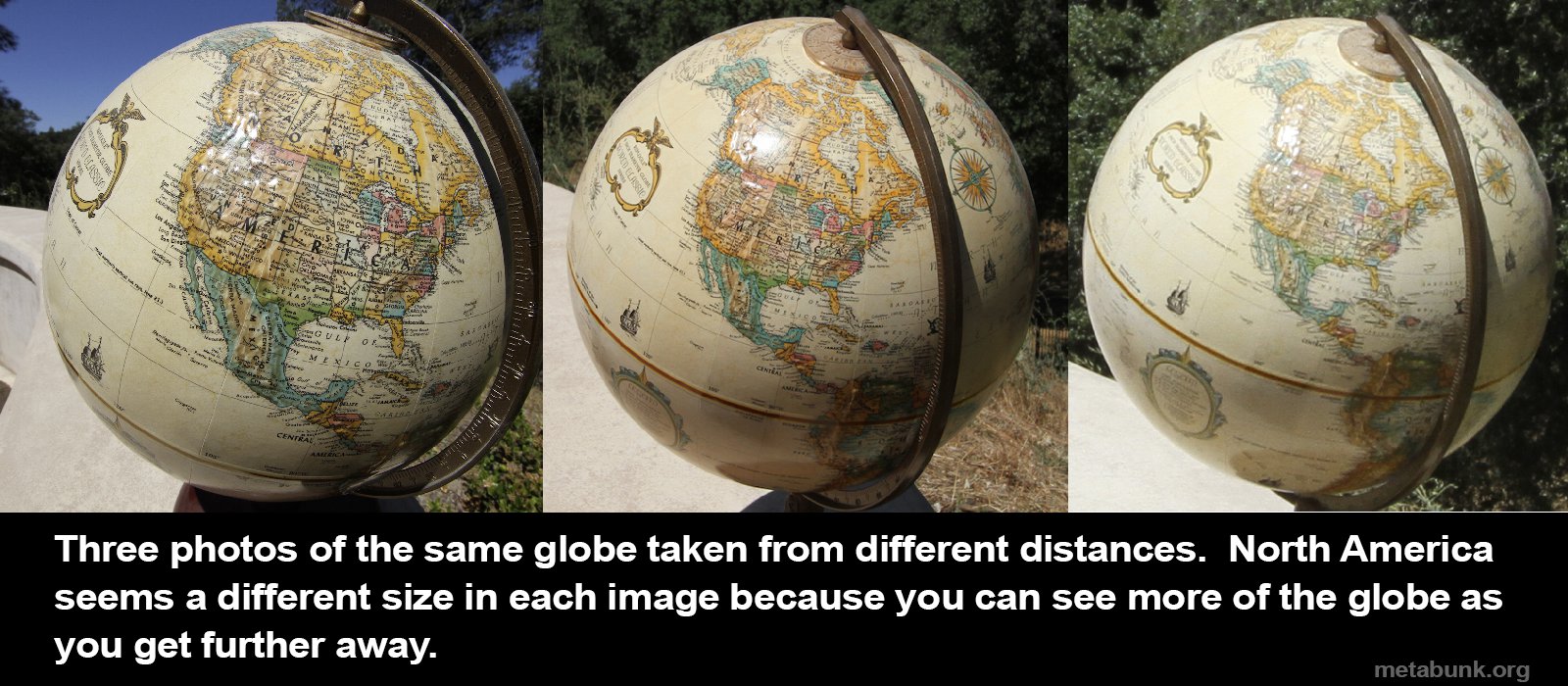
I get that. And it goes along with the critique of Appaulling's experiment proposal in which moon "rotation" or "roll" as I call it depends on the observer's rotation (azimuthal viewing). Like the bottom cartoon in this illustration:


This is the same "rotation" if a single observer tracks the moon during its transit or two observers each view the moon simultaneously from different locations. We know the moon appears to tilt/roll/rotate in that axis and why.

But that's not peculiar to a globe earth. On a flat plane earth, observers are going to see a different orientation of the moon depending on where they are on earth. The degree of "tilt" or the amount of difference between what observers see won't be the same, but then I don't have a baseline for globe earth to know what to compare a flat earth prediction to. All we know is that both globe and flat earth geometries can explain why the moon will appear oriented differently to different observers (or "roll" throughout the night). 

Depending on what you think the FE is like and where/what you think the moon is, you'll get different answers for what you should see. I've only really considered the usual Gleason map with the moon circling over it at 3000 miles. If there are any FEs out there who have an idea about this, please share. How does the moon move in your model? Do you have a prediction for how it should look when viewed from different places? I could probably help come up with that prediction if you explain your favorite model.

But you won't get different answers if simply asking the question "will the moon appear to rotate?" On the other board, they "violently" protested what globe believers were saying must be true about flat earth. They do NOT say the moon will not appear to rotate. It will.

What I think I'm hearing for you is that the so-called apparent rotation will be different for flat earth, and we can't predict what it will be given the ambiguities of flat earth models. Okay. But I can't predict it for globe earth either. If I could, then I would have a baseline to compare any flat earth geometry against that would make the two distinguishable. I can't find a table or a calculator or a simulator anywhere that shows what the moon should look like if viewed along a particular azimuth from a particular globe location at a particular date and time. Flat earth doesn't have that, but neither does the globe. It ought to be calculate-able, I know. I just don't know how to do it and it doesn't exist anywhere that I can find.

I thought I had a handle on the apparent moon orientation from my location, but was surprised to see that even on the same azimuth, and the same elevation, the moon "tilted" from 3 consecutive nights of full/near-full moon.

So, what's to be gained from having people participate in a multi-location, simultaneous full moon image capture? We already know the moon will appear oriented differently to each observer. FE claims that is true of flat earth too. So? Where does that leave us?

What Appaullingly was pitching was something different. It was the effect of earth's curvature and the resulting "tilt" of observers on different parts of the globe with respect to what each considered "up." That is a feature that is non-existent on a flat surface. Everyone on a flat surface has the same "up."

But how does that difference translate to how the moon is oriented? I don't know. If the moon is rotating for everyone, we can't just observe rotation. We need to have a baseline and make a prediction as to how much the moon will "roll" based on where one is observing from. And be able to discriminate how much apparent rotation is due to azimuth and how much might be due to global curve.

I'm lost as to how to do that. I get what Appaullingly was proposing (I think), but I also completely understand the criticism of it from the flat earthers. I'm all for collecting images and comparing, but I need to know what we're looking for and how globe earth is predicting something that the flat earth model can't demonstrate.

I'm hoping Paul re-joins when his stint in the cornfield expires, or that he sees this and chimes in. Because as much as I have enjoyed the subject, I'm kind of frustrated myself.

17
I agree. That would be very worthwhile. I would also like to ask for FE predictions of the results before the experiment is conducted. What do the various FE models say should happen?
I'd like to know what the RE prediction is, and why would it be different from FE?

This is sort of along the lines of what we were doing (and can still try again in July):


But this is what you're saying would be worthwhile?


I'm still not clear on how this would present any distinction between FE and RE that isn't already ambiguous taking the upper approach.

18
My camera crapped out before the moon rose above the ridge, so here's a cell phone photo. Best I could do... Will try again next month.
Interesting. My work blocks inline images from Dropbox?

Anyway, I saw the photo at home and it doesn't have enough detail to really compare "roll" orientation.

I'm up for doing this again next month. On the other board, Svarrior moved the discussion to The Lounge, but with Rabinoz's photo here, we only had 3 anyway (London, San Diego, and Brisbane).

I posted a composite of all three nights bracketing the fullest moon from San Diego. I was surprised to see the moon tilted slightly from night to night, even when on nearly the same azimuth and elevation.

So I really don't understand the dynamics/geometry of what's happening on the globe earth, much less how to understand what it would look like on a flat earth, and whether or not the two would be distinguishable.


19
Remember to take pictures of the Moon tomorrow as close to the local Moon rise as possible. Post the images here or in the thread in the other forum.
I might've confused people. Thread is saying June 28th, but I've been pitching June 27th. I've got a 99.9% full moon tonight.


San Diego
N33.0 W117.1
8:07PM PDT
Elevation: 3.55°
Azimuth: 118°
99.9% full

20
A little early:


7:38 PDT San Diego
6° elevation
119° azimuth
98.8% full

21
Reminder: full moon Wednesday (6/27).  Capture your images at moonrise or when moon is low on the horizon. Close to sunset for most.


22
I'd be happy to take some pictures for you. Los Angeles area (pretty close to San Diego sadly).
You might have get a clearer sky, especially if you're inland. Sign up.

23
Flat Earth General / Re: Looking for people to do some experiments
« on: June 18, 2018, 11:41:27 PM »

24
Flat Earth General / Re: Looking for people to do some experiments
« on: June 18, 2018, 11:27:27 PM »

25
Flat Earth General / Re: Looking for people to do some experiments
« on: June 18, 2018, 11:12:51 PM »

26
Flat Earth General / Re: Looking for people to do some experiments
« on: June 18, 2018, 10:49:29 PM »
Yup. You were corresponding with me.

Come on, people! Let's get this done. Especially all you who count yourselves as empiricists.  8)

27
Flat Earth General / Re: Looking for people to do some experiments
« on: June 18, 2018, 06:01:52 PM »
Is there an update on this?

28
So, technically, I'm a government employee?
Intern

29
Flat Earth General / Re: Looking for people to do some experiments
« on: June 12, 2018, 11:47:36 PM »
I've gotten 5 responses to the pre-experiment form so far, and the answers are varied nicely. I'm pretty excited about that. Has anyone taken the photo yet or done the measurements?

Email me your photo and graph at [email protected] (or PM it to me if you don't want to email)
I'm done. Will send.

30
Flat Earth General / And to Think I Trusted You, FlatEarthSociety.Org
« on: June 12, 2018, 07:07:49 PM »
 :o

Jump to 14:54


Pages: [1] 2 3 ... 5